
Like queries, we can also perform joins based on the location of the target and reference features. For this task, we need geometries in both the layers. This is a very handy operation when there are no common columns for joining and making one would require excessive work. To avoid ambiguity, we must have a spatial relationship able to do a one-on-one mapping between features. If not, QGIS will either pick the first matching feature or attempt to calculate statistics from the multiple target candidates.
Let's have an example, say, we would like to fill our administrative boundaries layer with population data. Our GeoNames layer has this kind of data, but they do not have a common column. If we join the whole GeoNames layer to the polygons, we would get unpredictable results. Therefore, we need to filter our GeoNames layer in such a way that only one point remains for every polygon. We can build a filter like this; we only have to select the feature codes representing our administrative divisions. In my case, the first-level administrative division contains my study area; therefore, my filter looks like this:
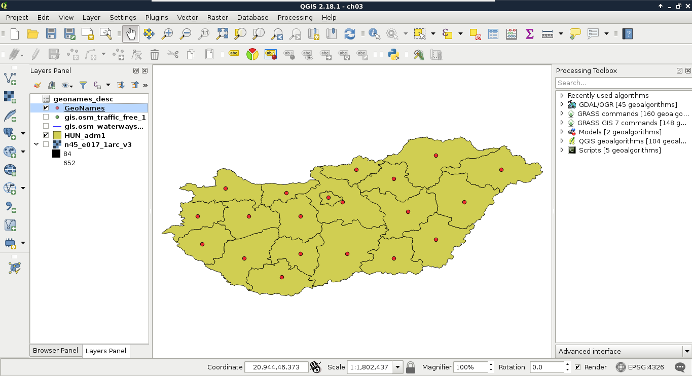
"featurecode" = 'ADM1'
By applying the filter, we should get one point per administrative division:
The only thing left to do now is to run the spatial join algorithm. We can find it in the Processing Toolbox. Under QGIS geoalgorithms, we have to expand the Vector general tools menu, where we can find the Join attributes by location tool. Its dialog is similar to the Select by location tool, thus, we have to provide two layers and a spatial predict. The Target vector layer is our administrative boundary layer, the Join vector layer is our GeoNames layer, while the spatial predict is intersects. Additionally, we have to provide a join method, which should be the default, and pick the first located feature. Finally, we have to provide a path to the output file as QGIS builds a new layer with the joined tables:
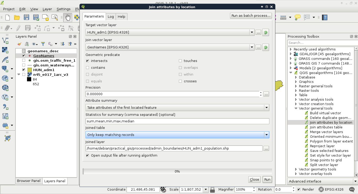
After the algorithm finishes, we can see our new layer added to the map. The only limitation of the spatial join in QGIS is the lack of options for selecting relevant columns. It joins every column from the joined layer to our target layer. We can remove every unnecessary column from the new layer's attribute table.