Table of Contents for
Mastering OpenLayers 3
 Mastering OpenLayers 3
Published by
Packt Publishing, 2016
Mastering OpenLayers 3
Published by
Packt Publishing, 2016
- Cover
- Table of Contents
- Mastering OpenLayers 3
- Mastering OpenLayers 3
- Credits
- About the Author
- About the Reviewer
- www.PacktPub.com
- Preface
- What you need for this book
- Who this book is for
- Conventions
- Reader feedback
- Customer support
- 1. Creating Simple Maps with OpenLayers 3
- Structure of OpenLayers 3
- Building the layout
- Using the API documentation
- Debugging the code
- Summary
- 2. Applying Custom Styles
- Customizing the default appearance
- Styling vector layers
- Customizing the appearance with JavaScript
- Creating a WebGIS client layout
- Summary
- 3. Working with Layers
- Building a layer tree
- Adding layers dynamically
- Adding vector layers with the File API
- Adding vector layers with a library
- Removing layers dynamically
- Changing layer attributes
- Changing the layer order with the Drag and Drop API
- Clearing the message bar
- Summary
- 4. Using Vector Data
- Accessing attributes
- Setting attributes
- Validating attributes
- Creating thematic layers
- Saving vector data
- Saving with WFS-T
- Modifying the geometry
- Summary
- 5. Creating Responsive Applications with Interactions and Controls
- Building the toolbar
- Mapping interactions to controls
- Building a set of feature selection controls
- Adding new vector layers
- Building a set of drawing tools
- Modifying and snapping to features
- Creating new interactions
- Building a measuring control
- Summary
- 6. Controlling the Map – View and Projection
- Customizing a view
- Constraining a view
- Creating a navigation history
- Working with extents
- Rotating a view
- Changing the map's projection
- Creating custom animations
- Summary
- 7. Mastering Renderers
- Using different renderers
- Creating a WebGL map
- Drawing lines and polygons with WebGL
- Blending layers
- Clipping layers
- Exporting a map
- Creating a raster calculator
- Creating a convolution matrix
- Clipping a layer with WebGL
- Summary
- 8. OpenLayers 3 for Mobile
- Responsive styling with CSS
- Generating geocaches
- Adding device-dependent controls
- Vectorizing the mobile version
- Making the mobile application interactive
- Summary
- 9. Tools of the Trade – Integrating Third-Party Applications
- Exporting a QGIS project
- Importing shapefiles
- Spatial analysis with Turf
- Spatial analysis with JSTS
- 3D rendering with Cesium
- Summary
- 10. Compiling Custom Builds with Closure
- Configuring Node JS
- Compiling OpenLayers 3
- Bundling an application with OpenLayers 3
- Extending OpenLayers 3
- Creating rich documentation with JSDoc
- Summary
- Index
OpenLayers 3 is the most robust open source web mapping library out there, highly capable of handling the client side of a WebGIS environment. Whether you know how to use OpenLayers 3 or you are new to it, this chapter will help you to create a simple map and either refresh some concepts or get introduced to them. As this is a mastering book, we will mainly discuss the library's structure and capabilities in depth. In this chapter we will create a simple map with the library, and revise the basic terms related to it.
In this chapter we will cover the following topics:
- Structure of OpenLayers 3
- Architectural considerations
- Creating a simple map
- Using the API documentation effectively
- Debugging the code
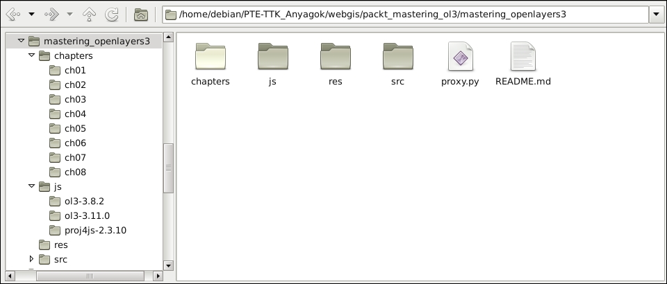
Take a look at the code provided with the book. You should see a js folder in which the required libraries are stored. For the first few chapters, ol.js, and ol.css in the ol3-3.11.0 folder will be sufficient. The code is also available on GitHub. You can download a copy from the following URL: https://github.com/GaborFarkas/mastering_openlayers3/releases. Take a look at the following screenshot:
Note
You can download the latest release of OpenLayers 3 from its GitHub repository at https://github.com/openlayers/ol3/releases. For now, grabbing the distribution version (v3.11.0-dist.zip) should be enough.
There is a security restriction in front end development, called Cross Origin Resource Sharing (CORS). By default, this restriction prevents the application from grabbing content from a different domain. On top of that, some browsers disallow reaching content from the hard drive when a web page is opened from the file system. To prevent this behavior, please make sure you possess one of the following:
- A running web server (highly recommended)
- Firefox web browser with
security.fileuri.strict_origin_policyset tofalse(you can reach flags in Firefox by openingabout:configfrom the address bar) - Google Chrome web browser started with the
--disable-web-securityparameter (make sure you have closed every other instance of Chrome before disabling security) - Safari web browser with Disable Local File Restrictions (in the Develop menu, which can be enabled in the Advanced tab of Preferences)