Table of Contents for
Python Geospatial Development - Third Edition
 Python Geospatial Development - Third Edition
Published by
Packt Publishing, 2016
Python Geospatial Development - Third Edition
Published by
Packt Publishing, 2016
- Cover
- Table of Contents
- Python Geospatial Development Third Edition
- Python Geospatial Development Third Edition
- Credits
- About the Author
- About the Reviewer
- www.PacktPub.com
- Preface
- What you need for this book
- Who this book is for
- Conventions
- Reader feedback
- Customer support
- 1. Geospatial Development Using Python
- Geospatial development
- Applications of geospatial development
- Recent developments
- Summary
- 2. GIS
- GIS data formats
- Working with GIS data manually
- Summary
- 3. Python Libraries for Geospatial Development
- Dealing with projections
- Analyzing and manipulating Geospatial data
- Visualizing geospatial data
- Summary
- 4. Sources of Geospatial Data
- Sources of geospatial data in raster format
- Sources of other types of geospatial data
- Choosing your geospatial data source
- Summary
- 5. Working with Geospatial Data in Python
- Working with geospatial data
- Changing datums and projections
- Performing geospatial calculations
- Converting and standardizing units of geometry and distance
- Exercises
- Summary
- 6. Spatial Databases
- Spatial indexes
- Introducing PostGIS
- Setting up a database
- Using PostGIS
- Recommended best practices
- Summary
- 7. Using Python and Mapnik to Generate Maps
- Creating an example map
- Mapnik concepts
- Summary
- 8. Working with Spatial Data
- Designing and building the database
- Downloading and importing the data
- Implementing the DISTAL application
- Using DISTAL
- Summary
- 9. Improving the DISTAL Application
- Dealing with the scale problem
- Performance
- Summary
- 10. Tools for Web-based Geospatial Development
- A closer look at three specific tools and techniques
- Summary
- 11. Putting It All Together – a Complete Mapping System
- Designing the ShapeEditor
- Prerequisites
- Setting up the database
- Setting up the ShapeEditor project
- Defining the ShapeEditor's applications
- Creating the shared application
- Defining the data models
- Playing with the admin system
- Summary
- 12. ShapeEditor – Importing and Exporting Shapefiles
- Importing shapefiles
- Exporting shapefiles
- Summary
- 13. ShapeEditor – Selecting and Editing Features
- Editing features
- Adding features
- Deleting features
- Deleting shapefiles
- Using the ShapeEditor
- Further improvements and enhancements
- Summary
- Index
We now have to create the Django project for our ShapeEditor system. To do this, cd into the directory where you want the project's directory to be placed, and type the following:
% django-admin.py startproject shapeEditor
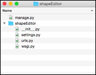
All going well, Django will create a directory named shapeEditor with the following contents:
Now that the project has been created, we need to configure it. To do this, edit the settings.py file in the shapeEditor package directory. We need to tell our project how to access the database we set up, and we also want to enable the GeoDjango extension.
Start by searching for the DATABASES variable, and change it to look like the following:
DATABASES = {
    'default': {
        'ENGINE'   : 'django.contrib.gis.db.backends.postgis',
        'NAME'     : 'shapeeditor',
        'USER'     : 'shapeeditor',
        'PASSWORD' : '...'
    }
}
Make sure you enter the password you set up for the shapeeditor Postgres user.
Next, search for the INSTALLED_APPS variable, and add the following to the end of the list of installed applications:
'django.contrib.gis',
While we're editing the settings.py file, let's make one more change that will save us some trouble down the track. Go to the MIDDLEWARE_CLASSES setting, and comment out the django.middleware.csrf.CsrfViewMiddleware line. This entry causes the addition of extra error checking when processing forms to prevent
cross-site request forgery (CSRF). Implementing CSRF support requires adding extra code to our form templates, which we won't be doing here in order to keep things simple.
This completes the configuration of our ShapeEditor project.