One of the ways you can limit the results of an incident query is by date. Using the Python datetime library, you can specify a date, then query incidents on that date, and get the geometry of the results as GeoJSON and add it to your map:
d=datetime.datetime.strptime('201781','%Y%m%d').date()
cursor.execute("SELECT address,crimetype,date,ST_AsGeoJSON(geom) from incidents where date =
'{}' ".format(str(d)))
incidents_date=cursor.fetchall()
for x in incidents_date:
    layer=json.loads(x[3])
    layergeojson=GeoJSON(data=layer)
    map.add_layer(layergeojson)
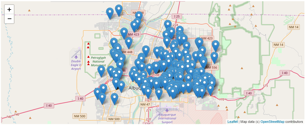
The previous code specifies a date (YYYYMD) of August 1, 2017. It queries the incidents table we're using, where date = d and returns the geometry as GeoJSON. It then uses the for loop you used for area commands, and beats to map the incidents.
The map you created earlier will now look like the screenshot as follows:
Besides specifying a specific date, you could get all the incidents where the date was greater than a specific day:
d=datetime.datetime.strptime('201781','%Y%m%d').date()
cursor.execute("SELECT address,crimetype,date,ST_AsGeoJSON(geom) from incidents where date >
'{}' ".format(str(d)))
Or, you could query dates at an interval earlier than today and now:
cursor.execute("select * from incidents where date >= NOW() - interval '10 day'")
The previous code uses the NOW() method and a 10 day interval. By specifying >=, you will get all the crimes that are 10 days old, and newer from the current day. I wrote this on November 24, 2017, so the results will be all incidents from November 14th until today.